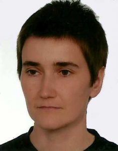
Place of employment:
- Warsaw University, Faculty of Geography and Regional Studies, Department of Geoinformatics, Cartography and Remote Sensing
Contact:
azmarz@uw.edu.pl, ORCID
Years with the University:
since 1th October 2013
Position:
research scientist (adiunct)
Education:
- 2003 Warsaw University of Life Sciences, M.Sc.
- 2010 UNIGIS Salzburg – University of Salzburg
- 2011 Warsaw University of Life Sciences, Ph.D.
Lectures
- Geographic Information System
- Programming and modeling in GIS
- Photogrammetry (UAS)
Supervision of MSc. students
- Detection of glaciers on Landsat imagery [Detekcja lodowców na obrazach Landsat], co-supervisor: dr Michał Pętlicki, defence: 10.07.2017
- Unmanned aerial vehicle for photogrammetry [Fotolotniczy system bezzałogowy], defence 09.2016
- Automatic detection of Adélie penguin individuals from digital images [Automatyczna detekcja osobników pingwinów białookich ze zdjęć cyfrowych], co-supervisor: dr Małgorzata Korczak-Abshire, defence 09.2016
- Generation of Digital Terrain Model with use of free software [Opracowanie modelu terenu z wykorzystaniem darmowego oprogramowania], defence 06.07.2015
- Photogrammetric analysis of the images obtained from an unmanned aerial vehicle in the Inpho software [Fotogrametryczna analiza zdjęć pozyskanych z bezzałogowego statku powietrznego w oprogramowaniu Inpho], defence 02.10.2015
- Object Based Image Analysis method for analysis of anthropogenic changes on images obtained from UAV [Zastosowanie klasyfikacji obiektowej do analizy zmian antropogenicznych na zdjęciach pozyskanych z Bezzałogowego Statku Powietrznego], defence 02.10.2015
Supervision of BA students
- Analysis of influence of meteorological conditions on the possibility to perform flights by Unmanned Aerial Vehicles [Analiza wpływu warunków meteorologicznych na możliwość wykonywania lotów bezzałogowymi statkami powietrznymi], defence 09.2016
- A Image J software application for automatic detection of selected marine bird species obtained from aerial images [Zastosowanie oprogramowania Image J do automatycznej detekcji wybranych gatunków ptaków morskich ze zdjęć lotniczych], co-supervisor: dr Małgorzata Korczak-Abshire, defence: 22.07.2015
Publication list:
2021
- Kreczmer K, Dąbski M and Zmarz A (2021) Terrestrial Signature of a Recently-Tidewater Glacier and Adjacent Periglaciation, Windy Glacier (South Shetland Islands,
Antarctic). Frontiers in Earth Science 9:671985. DOI: 10.3389/feart.2021.671985
2020
- Dąbski M., Zmarz A., Rodzewicz M., Korczak‐Abshire M., Karsznia I., Lach K.M., Rachlewicz G., Chwedorzewska K.J., 2020. Mapping Glacier Forelands Based on UAV BVLOS Operation in Antarctica. Remote Sensing 12(4). DOI: 10.3390/rs12040630
- Rotnicka J.,Dłużewski M.,Dąbski M.,Rodzewicz M.,Włodarski W.,Zmarz A., 2020
Accuracy of the UAV-Based DEM of Beach–Foredune Topography in Relation to Selected Morphometric Variables, Land Cover, and Multitemporal Sediment Budget. Estuaries and Coasts, doi.org/10.1007/s12237-020-00752-x
2019
- Korczak-Abshire M., Zmarz A., Rodzewicz M., Kycko M., Karsznia I., Chwedorzewska K. J., 2019. Study of fauna population changes on Penguin Island and Turret Point Oasis (King George Island, Antarctica) using Unmanned Aerial Vehicle. Polar Biology, 42:217-224. DOI: 10.1007/s00300-018-2379-1
2018
- Zmarz A., Rodzewicz M., Dąbski M., Karsznia I., Korczak-Abshire M., Chwedorzewska K. J., 2018. Application of UAV BVLOS remote sensing data for multi-faceted analysis of Antarctic ecosystem, Remote Sensing of Environment, 217: 375-388, DOI: 10.1016/j.rse.2018.08.031
2017
- Znój A., Chwedorzewska K.J., Androsiuk P., Cuba-Diaz M., Giełwanowska I., Koc J., Korczak-Abshire M., Grzesiak J., Zmarz A., 2017. Rapid environmental changes in the western Antarctic Peninsula region due to climate change and human activity. Applied Ecology and Environmental Research, DOI: http://dx.doi.org/10.15666/aeer/1504_525539
- Dąbski M., Zmarz A., Pabjanek P., Korczak-Abshire M., Karsznia I., Chwedorzewska K., 2017. UAV-Based detection and spatial analyses of periglacial landforms on Demay Point (King George Island, South Shetland Islands, Antarctica), Geomorphology (published online) DOI: 10.1016/j.geomorph.2017.03.033
- Witczuk J., Pagacz S., Zmarz A., Cypel M., 2017. Exploring the feasibility of unmanned aerial vehicles and thermal imaging for ungulate surveys in forests – preliminary results, International Journal of Remote Sensing (published online) DOI: https://doi.org/10.1080/01431161.2017.1390621
2016
- Kidawa A., Korczak-Abshire M., Zmarz A. UAV remote sensing of environmental changes on King George Island (South Shetland Islands): update on the results of the second field season 2015/2016. Information Papers ATCM38_ip077_e; ATCM38_att096_e submitted by Poland on XXXIX The Antarctic Treaty Consultative Meeting (ATCM), 23 May to 1 June 2016, Santiago, Chile
- Chwedorzewska K.J., Korczak-Abshire M., Zmarz A. 2016. „Niespokojnie nad lodami”. Academia http://www.naukaonline.pl/nasze-teksty/nauki-biologiczne/item/3379-niespokojnie-nad-lodami
- Zmarz A. , Korczak- Abshire M., Chwedorzewska K. 2015 UAV Antarctic Survey, Academia 1(45): http://www.scienceonline.pl/nasze-teksty/nauki-o-ziemi/item/449-uav-antarctic-survey
- Korczak-Abshire, M., A. Kidawa, A. Zmarz, R. Storvold, S.R. Karlsen, M. Rodzewicz, K. Chwedorzewska and A. Znój. 2016. Preliminary study on nesting Adélie penguins disturbance by unmanned aerial vehicles. CCAMLR Science, 23: 1–14. https://www.ccamlr.org/node/92888
2015
- Zmarz A., Korczak-Abshire, M., Storvold R., Rodzewicz M, and Kędzierska I. 2015. Indicator species population monitoring in Antarctica with UAV. The International Archives of the Photogrammetry, Remote Sensing and Spatial Information Sciences. ISPRS UAV-g2015 (Volume XL-1/W4) 30 August–2 September 2015, Toronto, Canada
- A. Kidawa, M. Korczak-Abshire, A Zmarz „UAV remote sensing of environmental changes on King George Island (South Shetland Islands): preliminary information on the results of the first field season 2014/2015”. XXXVIII Antarctic Treaty Consultative Meeting (ATCM), 31 May 2015, Sofia, Bulgaria.
- Korczak-Abshire M., Zmarz A., Storvold R., Rodzewicz M., Chwedorzewska K., Kidawa A., Znój A. Unmanned Aerial Vehicles based monitoring of indicator species populations on King George Island (Subarea 48.1). CCAMLR WG-EMM-15/48. CCAMLR Working Group on Ecosystem Monitoring and Management, 06 – 17 Jul, 2015, Warsaw, Poland.
2014
- Zmarz A., 2014: UAV – a useful tool for monitoring woodlands. Miscellanea Geographica-Regional Studies on Development. Volume 18, Issue 2 (Jun 2014)
- Hans Tømmervik, Stein-Rune Karlsen, Rune Storvold, Bernt Johansen, AnnaZmarz, Kjell-Sture Johansen, Kjell-Arild Høgda, Scott Goetz, Taejin Park,Pieter S. Beck, Lennart Nilsen Bogdan Zagajewski, Ranga B Myneni and JarleW. Bjerke 2014: Use of Unmanned Aircraft Systems (UAS) in Mapping of HighArctic plant communities in Adventdalen on Svalbard. EARSeL eProceedings, Special Issue: 34th EARSeL Symposium, 2014
2013
- Storvold, R., S.R. Karlsen, S.A. Solbø, B. Johansen, K. Johansen, K.A. Høgda, H. Tømmervik, A. Zmarz & D. Joly. 2013. Detection of Vehicle Tracks and Vegetation Damages Caused by use of Snowmobiles in the Longyearbyen Area on Svalbard using Unmanned Aircraft. Abstract ID B41B-0394 presented at the 2013 Fall Meeting, AGU, San Francisco, California., 9-13 December.
2011
- Zmarz A., Będkowski K., Miścicki S., Plutecki W., 2011: Assessment of health condition of the spruce based on analysis of multispectral photograph taken with digital cameras carried by an unmanned aerial vehicle. Archives of Photogrammetry, Carthography and Remote Sensing, Vol. 23, 2012, s. 541– 55
Projects:
- Weryfikacja innowacyjnej metody inwentaryzacji zwierzyny grubej z wykorzystaniem bezzałogowych statków powietrznych (BSP) oraz narzędzi teledetekcyjnych, w powiązaniu z szacowaniem szkód łowieckich w wielkoobszarowych uprawach rolnych. Finansowanie: DGLP. 2017-2020
- Remote Controlled and Autonomous Measurement Platforms Flagship (SSF). Project No. 246695. (2015-2016). Research activity.
- Polish-Norwegian Research Programme. A novel approach to monitoring the impact of climate change on Antarctic ecosystems. Project No. 197810. 2013-2016. Leader WP1 (Project management)
- EU, the Innovative Economy Operational Programme, Measure 1.4 – 4.1 R&D project No. UDA-POIG.01.04.00-14-047/09-00; UDA-POIG.04.01.00-14- 047/09-00: Development of technology for ortho-mosaic preparation from aerial photographs made by an unmanned aerial vehicle. Project co-author, main executor. 2009 – 2011
- Ministry of Science and Higher Education – targeted project No. 6 ZR6 2009C/07320 Using multispectral images taken by Unmanned Aerial Vehicles (UAV) for application in study of the environment condition on an example of listing biotic damages in forests. Project co-author, main executor. 2010 – 2011
- Ministry of Science and Higher Education – supervisor research grant NN 309 112537 Using unmanned aerial vehicles to acquire image data about the forest. Author, executor. 2009 – 2011


